Curso online : "OTUS.NoSQL" .
Proyecto : https://github.com/BorisPlus/mongodb_geo
Introducción
La geoinformación es cualquier información que refleje la ubicación, la forma y el tamaño de un objeto (en adelante, un objeto geográfico). Su contabilidad se realiza en cartografía, geología, meteorología, ordenación territorial, ecología, administración municipal, transporte, economía, defensa y muchas otras áreas. La geoinformación es parte integral del denominado Big Data, lo que conlleva la necesidad de desarrollar herramientas para su análisis y visualización.
El enfoque académico de escribir artículos significaba "información que refleja las propiedades ... de los objetos del mundo material". Sin embargo, en la práctica, estaba el hecho de que el entusiasta superpuso mapas de Google a través de la API estándar de dibujos con la topografía de la Tierra Media y la construcción de rutas para los héroes de J. Tolkien, que no es del todo "material". Otra unión con intangible es un ejemplo de conjuntos de datos como GeoIP , E.164 , ABC .
El resultado de la investigación es una herramienta para mostrar información sobre objetos geográficos almacenados en MongoDB en un mapa mediante acceso web. La interfaz se implementa mediante Leaflet (una biblioteca de JavaScript de código abierto para mapas interactivos móviles) y un conjunto de rutinas relacionadas para recuperar información de forma asincrónica desde la parte posterior. El servicio se desarrolla sobre la base del constructor de software "Dummy WSGI Framework" ( repositorio ) creado anteriormente en el curso "OTUS.Web-python" en el lenguaje de programación Python3 con el uso de WSGI.
MongoDB. .
, MongoDB . . , MongoDB , .
- MongoDB
<field>: { type: <GeoJSON type> , coordinates: <coordinates> }
- .
- , , . "", ( ) ().
, MongoDB .
mongo 192.168.102.99 --port 49326
---
> use otus
switched to db otus
> db.dropDatabase()
{ "dropped" : "otus", "ok" : 1 }
> use otus
switched to db otus
> db otus
> show collections
()
> db.meteorites.createIndex( { "ident": 1 }, { unique: true } )
> db.meteorites.createIndex( { "location" : "2dsphere" } )
geolocation
. "". , , location
, :
location: { type: 'Point' , coordinates: [ LON, LAT ] }
:
mongoimport --host 192.168.102.99 --port 49326 \
--db otus --collection meteorites --jsonArray \
--file ./foreign/meteorites/data.json
2021-03-28T10:28:09.443+0300 connected to: mongodb://192.168.102.99:49326/
2021-03-28T10:28:12.443+0300 [<span class="pl-c" style="box-sizing: border-box; color: var(--color-prettylights-syntax-comment);"><span class="pl-c" style="box-sizing: border-box; color: var(--color-prettylights-syntax-comment);">#</span>##.....................] otus.meteorites 1.62MB/10.1MB (16.0%)</span>
2021-03-28T10:28:15.443+0300 [<span class="pl-c" style="box-sizing: border-box; color: var(--color-prettylights-syntax-comment);"><span class="pl-c" style="box-sizing: border-box; color: var(--color-prettylights-syntax-comment);">#</span>########...............] otus.meteorites 3.97MB/10.1MB (39.4%)</span>
2021-03-28T10:28:18.443+0300 [<span class="pl-c" style="box-sizing: border-box; color: var(--color-prettylights-syntax-comment);"><span class="pl-c" style="box-sizing: border-box; color: var(--color-prettylights-syntax-comment);">#</span>###########............] otus.meteorites 5.39MB/10.1MB (53.4%)</span>
2021-03-28T10:28:21.443+0300 [<span class="pl-c" style="box-sizing: border-box; color: var(--color-prettylights-syntax-comment);"><span class="pl-c" style="box-sizing: border-box; color: var(--color-prettylights-syntax-comment);">#</span>################.......] otus.meteorites 7.23MB/10.1MB (71.6%)</span>
2021-03-28T10:28:24.443+0300 [<span class="pl-c" style="box-sizing: border-box; color: var(--color-prettylights-syntax-comment);"><span class="pl-c" style="box-sizing: border-box; color: var(--color-prettylights-syntax-comment);">#</span>####################...] otus.meteorites 8.83MB/10.1MB (87.5%)</span>
2021-03-28T10:28:27.443+0300 [<span class="pl-c" style="box-sizing: border-box; color: var(--color-prettylights-syntax-comment);"><span class="pl-c" style="box-sizing: border-box; color: var(--color-prettylights-syntax-comment);">#</span>######################.] otus.meteorites 9.71MB/10.1MB (96.3%)</span>
2021-03-28T10:28:28.453+0300 [<span class="pl-c" style="box-sizing: border-box; color: var(--color-prettylights-syntax-comment);"><span class="pl-c" style="box-sizing: border-box; color: var(--color-prettylights-syntax-comment);">#</span>#######################] otus.meteorites 10.1MB/10.1MB (100.0%)</span>
2021-03-28T10:28:28.454+0300 45716 document(s) imported successfully. 0 document(s) failed to import.
, 45716 , ( Meridiani Planum), ( Can't extract geo keys: ... longitude/latitude is out of bounds, ...
, ).
db.meteorites.remove({"ident" : "32789"});
7315 , . - . , .
db.meteorites.updateMany(
{"geolocation":{$exists:true}},
[{
$set: {
"location" : {
"type": "Point",
"coordinates" : [
{ $toDouble: "$geolocation.longitude" } ,
{ $toDouble: "$geolocation.latitude" }
]
}
}
}]
);
MongoDB meteorites
location
38400 45716.
: { , }
MongoDB (If specifying latitude and longitude coordinates, list the longitude first and then latitude
). , Leaflet - { , }
. , MongoDB "" { lon: , lat: }
. , . , MongoDB { , }
.
()
, . - API WikiMapia.
WikiMapia , ( , ). ( ) API- .
, :
db.geo_wikimapia_polygons.createIndex( { "ident": 1 }, { unique: true } )
db.geo_wikimapia_polygons.createIndex( { "area" : "2dsphere" } )
Python-: - (
UPSERT
) (bulk_write(instructions)
), ( ) . - .
area: { type: 'Polygon' , coordinates: [[ [LON_1, LAT_1], [LON_2, LAT_2], ..., [LON_1, LAT_1] ]] }
WikiMapia:
python3 ./foreign/onetime_static_load_polygons_wikimapia.py
Page 1 has docs count 50
Page 2 has docs count 50
...
Page 37 has docs count 35
Max page 37 with some data
MongoDB :
> db.geo_wikimapia_polygons.count()
1832 .
: MongoDB ( 3.1.6 RFC 7946 "GeoJSON" August 2016). , , , ( MongoDB Edges <number K> and <number M> cross. Edge locations in degrees: [Kx1, Ky1]-[Kx2, Ky2] and [Mx1, My1]-[Mx2,My2]
). , , "", ( MongoDB Loop is not closed
). WikiMapia . 1835 , (36 * 50 + 35 = 1835 ), 1832 .
()
: ( 3.1.4 RFC 7946 "GeoJSON" August 2016), ( ).
Python3 requests
, pymongo
multiprocessing
. ( ). . -. "" . "", , .
Python-: , . "" .
MongoDB "". path
, .
:
path: { type: 'LineString' , coordinates: [ [LON_1, LAT_1], [LON_2, LAT_2], ..., [LON_N, LAT_N] ] }
: $geoIntersects
$nearSphere
.
$geoIntersects , . , ( , ) () (), . , , .
: , " ". , , MongoDB.
$nearSphere MongoDb "" ( - ).
$geoWithin ( , ) $near ( ) .
$near
$nearSphere
, " ", ($maxDistance
) , ($minDistance
). , "" : ".", "" , .
Web- "Dummy WSGI Framework" (), ( 45 ).
pip3 install -r ./service/requirements.txt
uwsgi --http 127.0.0.1:8080 --wsgi-file ./service/application.py
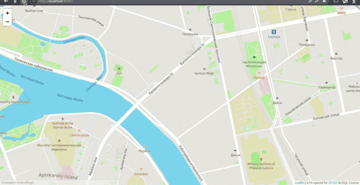
http://127.0.0.1:8080 . -, . .
: GIF- Peek.
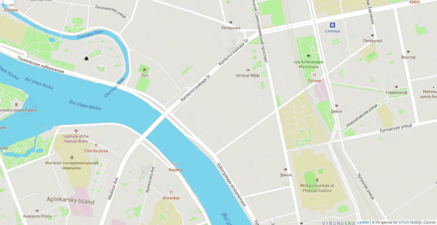
( . - "7") .
, . . , "" , Leaflet .
NASA 64 , . ( ).
.

> db.meteorites.find({"location.coordinates": [13.43333,58.58333] }).count()
64
> db.meteorites.find({"location.coordinates": [13.43333,58.58333] }, {name: 1, _id: 0})
{ "name" : "Osterplana" }
{ "name" : "Österplana 002" }
{ "name" : "Österplana 003" }
...
{ "name" : "Österplana 064" }
"" "Österplana", (.).
:
db.geo_yandex_taxi.deleteMany({})
db.geo_yandex_taxi.createIndex( { "ident": 1 }, { unique: true } )
db.geo_yandex_taxi.createIndex( { "last_point" : "2dsphere" } )
db.geo_yandex_taxi.createIndex( { "path" : "2dsphere" } )
:
python3 ./foreign/upsert_yandex_taxi_loop.py
9 2.6140940189361572
9 2.481816291809082
9 2.528238296508789
9 2.374605894088745
9 2.5337154865264893
9 2.7297616004943848
9 2.60577392578125
9 2.586944818496704
9 2.5660433769226074
"" :
{'id': 'bcc095db8e3b56e057caebdb97af5694', 'display_tariff': 'business', 'free': True, 'static_icon': False,
'positions': [{'lon': 30.326291, 'lat': 59.974395, 'direction': 50.0, 'timestamp': '2021-03-24T23:49:01.000000+0000'},
{'lon': 30.326291, 'lat': 59.974395, 'direction': 50.0, 'timestamp': '2021-03-24T23:48:52.000000+0000'},
{'lon': 30.326291, 'lat': 59.974395, 'direction': 50.0, 'timestamp': '2021-03-24T23:48:43.000000+0000'},
{'lon': 30.326291, 'lat': 59.974395, 'direction': 50.0, 'timestamp': '2021-03-24T23:48:34.000000+0000'}]}
, "" .
.
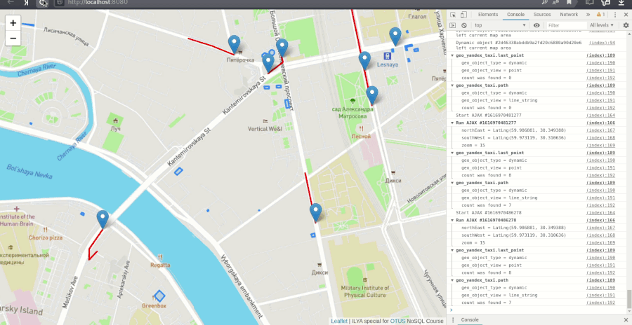
. ( "" ).
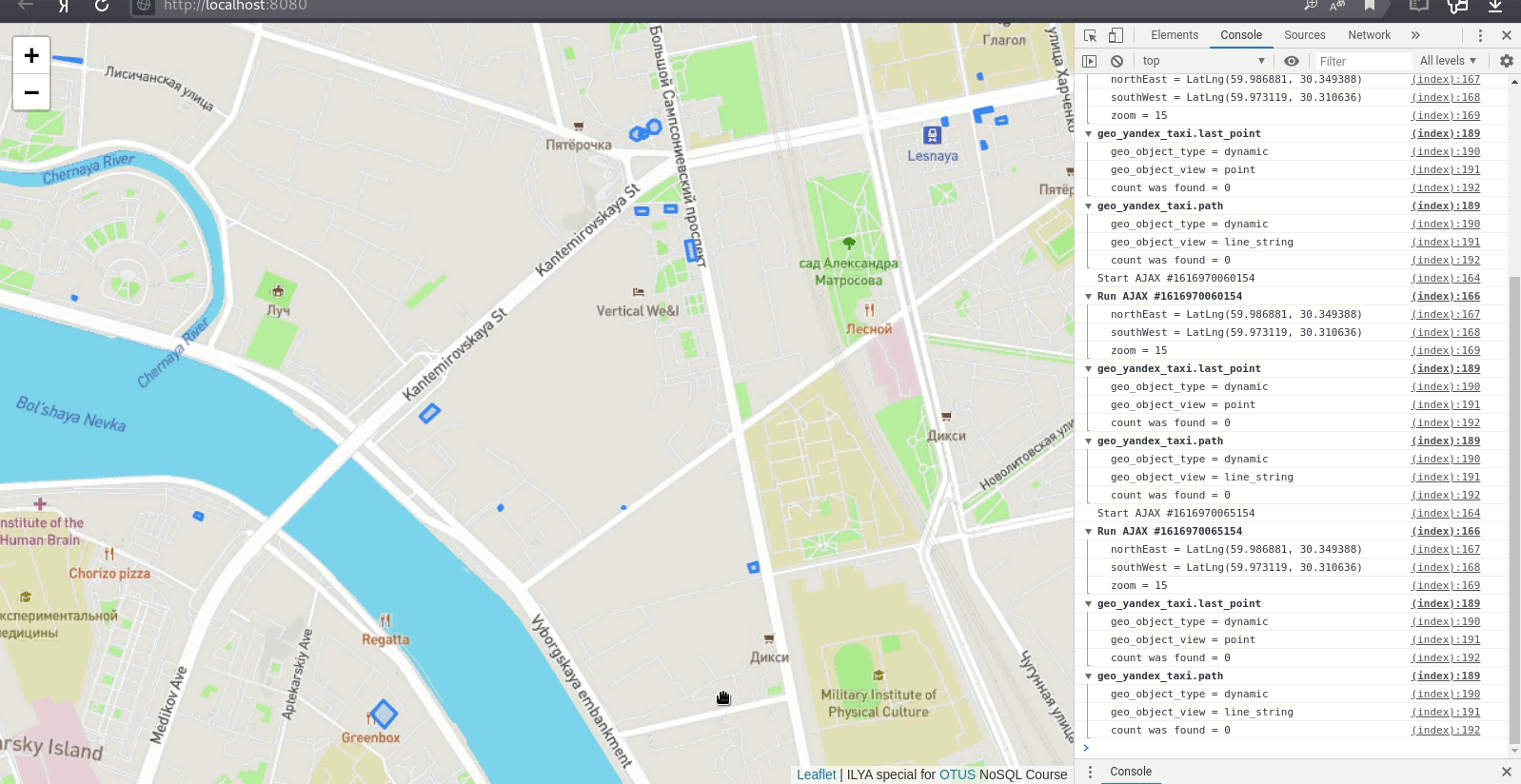
http://localhost:8080/circle/ , , .

: near
nearSphere
2d
2dsphere
, :
error processing query: ns=otus.geo_wikimapia_polygonsTree: GEONEAR field=area maxdist=500 isNearSphere=0
Sort: {}
Proj: { _id: 0 }
planner returned error :: caused by :: unable to find index for $geoNear query, full error: {'ok': 0.0, 'errmsg': 'error processing query: ns=otus.geo_wikimapia_polygonsTree: GEONEAR field=area maxdist=500 isNearSphere=0\nSort: {}\nProj: { _id: 0 }\n planner returned error :: caused by :: unable to find index for $geoNear query', 'code': 291, 'codeName': 'NoQueryExecutionPlans'}
.
base_config.py
("", ""), MongoDB ("meteorites", "geo_wikimapia_polygons", "geo_yandex_taxi") ("location", "area", "last_point", "path"), GeoJSON- ("Point", "LineString", "Polygon"), :
...
MONGODB_DB_COLLECTIONS = dict(
static={
"meteorites": {
"location": POINT_OBJECT,
},
"geo_wikimapia_polygons": {
"area": POLYGON_OBJECT,
},
},
dynamic={
"geo_yandex_taxi": {
"last_point": POINT_OBJECT,
"path": LINE_STRING_OBJECT,
},
},
)
...
, ("", ""), ("", "", "") , MongoDB .
, HTML- JavaScript, . .
, HTML- .
"" AJAX
JavaScript (AJAX). , "", , . . AJAX-, .
function get_data(...){
...
if (xhr && !(xhr.readyState === 4)) {
xhr.abort();
console.log('Previous AJAX #' + xhr.__dt + ' was aborted');
}
clearTimeout(timer);
xhr = new XMLHttpRequest();
xhr.responseType = 'json';
xhr.__dt = Date.now();
console.log('Start AJAX #' + xhr.__dt);
timer = setTimeout(function() {
// find objects in area.
}
}
AJAX- web- "" (F12).
MongoDB WGS84 (MongoDB geospatial queries on GeoJSON objects calculate on a sphere; MongoDB uses the WGS84 reference system for geospatial queries on GeoJSON objects
) ( "wgs84").
Leaflet - EPSG 3857.
, EPSG 3857 85.06°S
85.06°N
.
Leaflet CRS "L.CRS.EPSG4326", MongoDB.
, MongoDB . , , Leaflet , :
pymongo.errors.OperationFailure: longitude/latitude is out of bounds, lng: 561.213 lat: 89.9823 ...
Valid longitude values are between -180 and 180, both inclusive.
Valid latitude values are between -90 and 90, both inclusive.
, "" ( , "" ""), - "" ( ).
β-
( MongoDB 4.0) .
, , MongoDB. .
, Leaflet . , - (, , , , ) ( , - , (, ) ).
, .
, "".


Gracias a los cursos "OTUS" ( "OTUS.Web-python" 2018 y "OTUS.NoSQL" 2020) por la experiencia adquirida en el desarrollo Fullstack (en particular, la integración de Python, Javascript y MongoDB).